Live Tides
NOTICES TO MARINERS
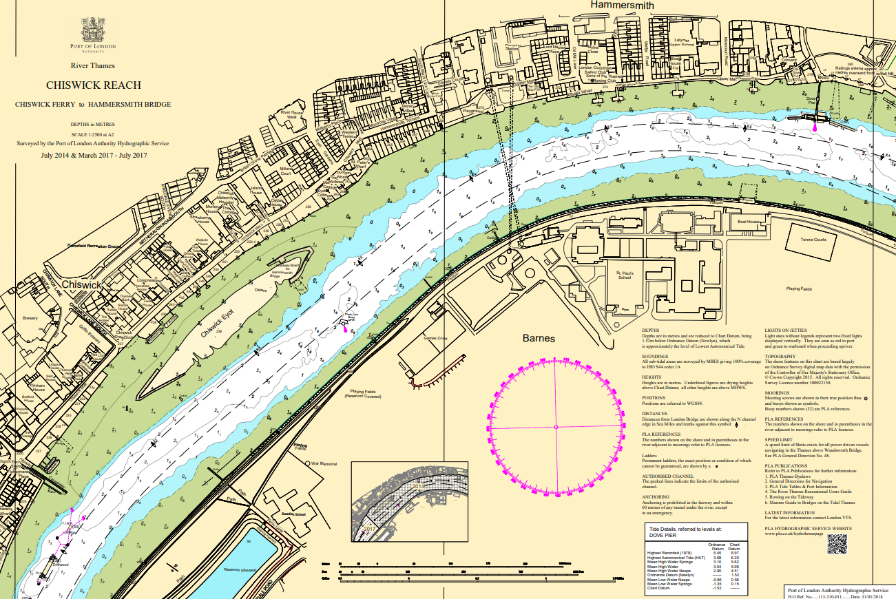
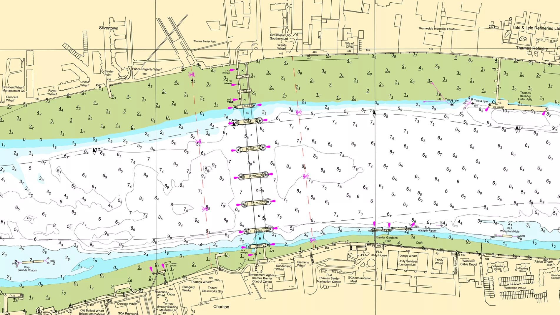
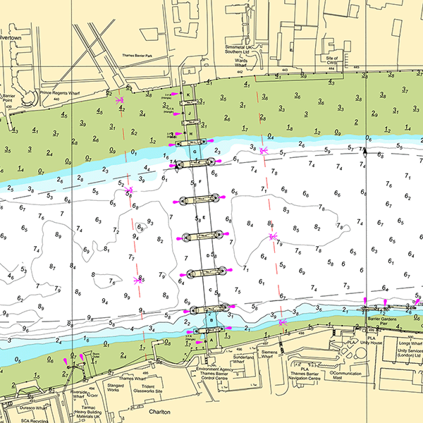
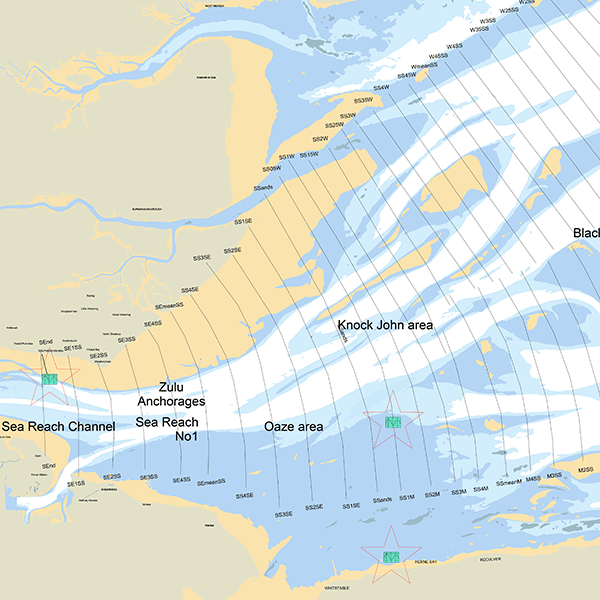
Charts & Surveys
Incident reporting
Life-threatening emergencies on the river:
Call 999 and ask for the Coastguard
For near miss, safety observations and incident reporting click below
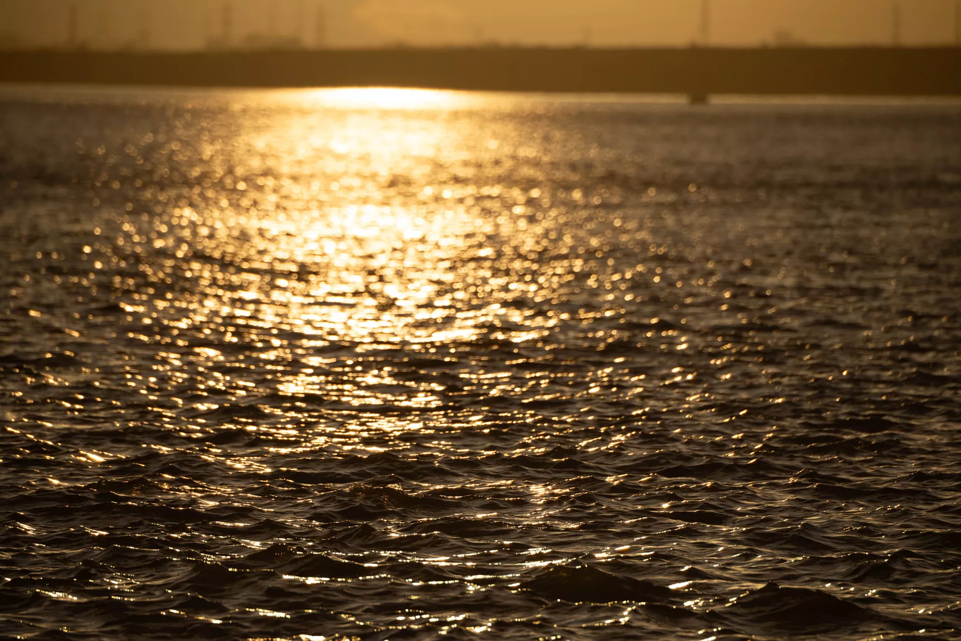
Hydrography
We know the Thames
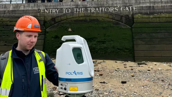
A Hydrographer’s path from study to the PLA
Read more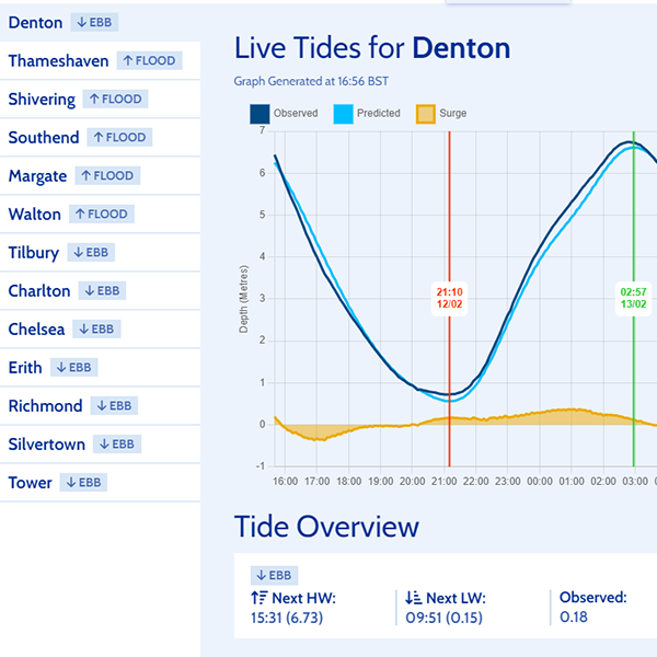
Our extensive knowledge and array of tools allow us to offer bespoke solutions
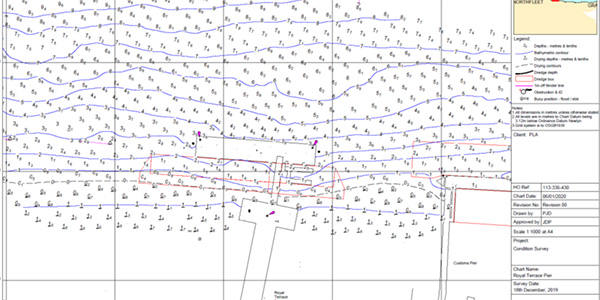
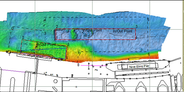
Need to a monitor the water depths on your berth? We can acquire a bathymetric survey and chart this for you.
Need support for a planned dredging project? We can assist and advise on your dredging project throughout its lifecycle.
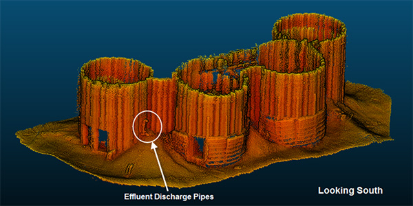
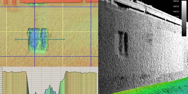
Need to confirm asset integrity? We can investigate the status of your physical assets using a range of survey tools.
Need support for civil engineering project? We can assist with a suite of surveys, solutions and services to aid your project.
Need a UXO survey prior to works? We can acquire a suite of surveys to provide a comprehensive UXO survey package.
Need geotechnical or geophysical data? From 3D surveys to cone penetration tests, we can assist in capturing the data you need.
Leveraging our expertise for clients
Thames Vision 2050
We will create the UK’s leading port, central to the nation’s economy, with Net Zero emissions
A clean river, free of pollution and rubbish, supporting more sport, passengers and freight. A resilient Estuary, adapting to climate change and richer in wildlife. A more diverse Thames, providing jobs, learning and enjoyment to the whole community, and always, everyone, staying safe.