Live Tides
NOTICES TO MARINERS
Charts & Surveys
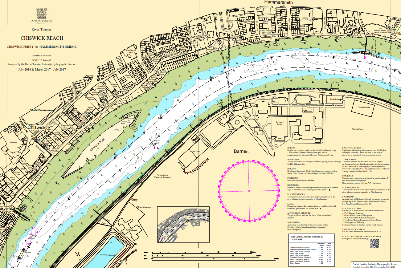
Hydrographic charts, surveys and miniplots are available online from our GIS system
Incident reporting
Life-threatening emergencies on the river:
Call 999 and ask for the Coastguard
For near miss, safety observations and incident reporting click below
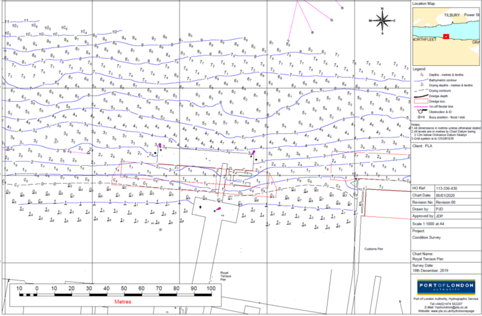
Survey of depths on berth
Need to know what depths you have on your berth?
We can acquire a bathymetric survey and chart this for you.
Benefits:
- Reduce the risk of vessel grounding
- Can be used to guide for when dredging is required to maintain depths
- Know what draft of berth you can safely accept
- Know about any obstruction
Deliverables:
- xyz point cloud
- Web based 3D visualisation of the point cloud data
- Plots
- Survey report(s) specifying including:
- Controlling depths on the berths.
- Outline of operations
- The extent of any obstructions, scour or other notable features