Live Tides
NOTICES TO MARINERS
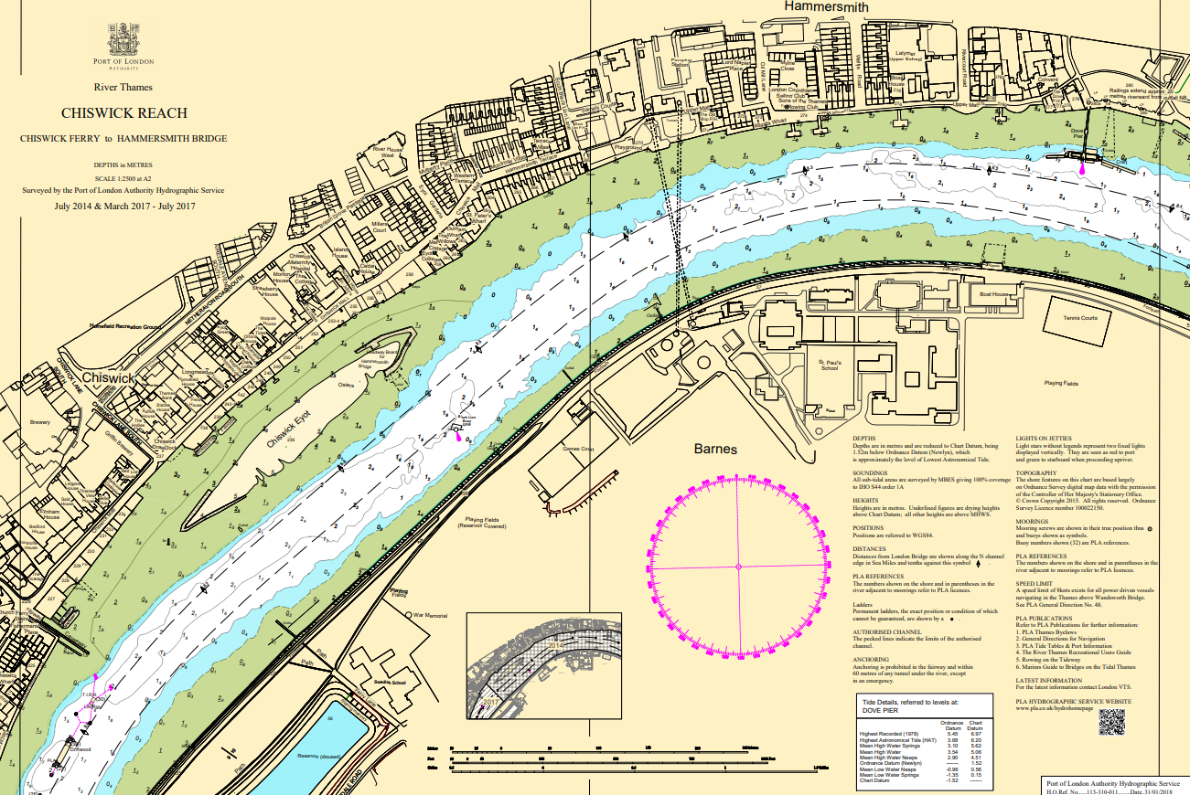
Charts & Surveys
Incident reporting
Life-threatening emergencies on the river:
Call 999 and ask for the Coastguard
For near miss, safety observations and incident reporting click below

Gangway angle calculator
This Gangway Angle Calculator has been produced by the PLA to assist Masters of ships planning to use specified jetties, piers or berths with checking if their gangway / accommodation ladder arrangements are likely to comply or not with certain applicable regulations and guidance. Whilst we hope that this Gangway Angle Calculator will be found helpful, it remains the Master’s responsibility to ensure that safe and compliant ship-shore access will be provided on the vessel. Although effort has been made to ensure the accuracy of the information provided in the Gangway Angle Calculator, the PLA assumes no responsibility for and give no guarantees, undertakings or warranties concerning the accuracy, completeness or up to date nature of the information provided in this Gangway Angle Calculator and does not accept any liability whatsoever arising from any errors or omissions.