Live Tides
NOTICES TO MARINERS
Charts & Surveys
Incident reporting
Life-threatening emergencies on the river:
Call 999 and ask for the Coastguard
For near miss, safety observations and incident reporting click below
Shop
Tide Tables and Port Information Book 2025

Available to order
Tide predictions for Walton-on-the-Naze, Margate, Shivering Sand, Southend-on-Sea, Tilbury, North Woolwich and London Bridge (Tower Pier) for 2024. General information on the Port of London and the Port of London Authority.
For UK customers
£3.50 inc p&p
(1st class postage for UK customers)
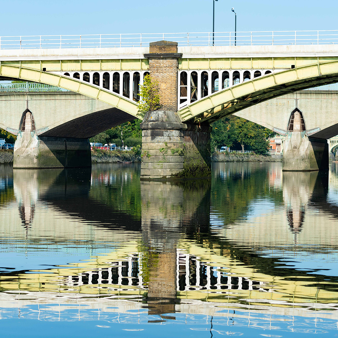
Mariners' Guide to Bridges on the Tidal Thames
Currently out of stock in print.
The June 2012 edition of the Mariners' Guide to Bridges on the Tidal Thames provides an overview of navigating London's bridges, and highlights the safety issues associated with this challenging environment. The book covers every bridge in detail, each presented on a double page; illustrating the bridge with a photograph, side elevation drawing and digital chart extract. The particular issues associated with navigating through and in the area around the bridge completes each entry.
Also included in comprehensive appendices are bridge clearance tables, silhouettes, tidal set and other useful information for the navigator.
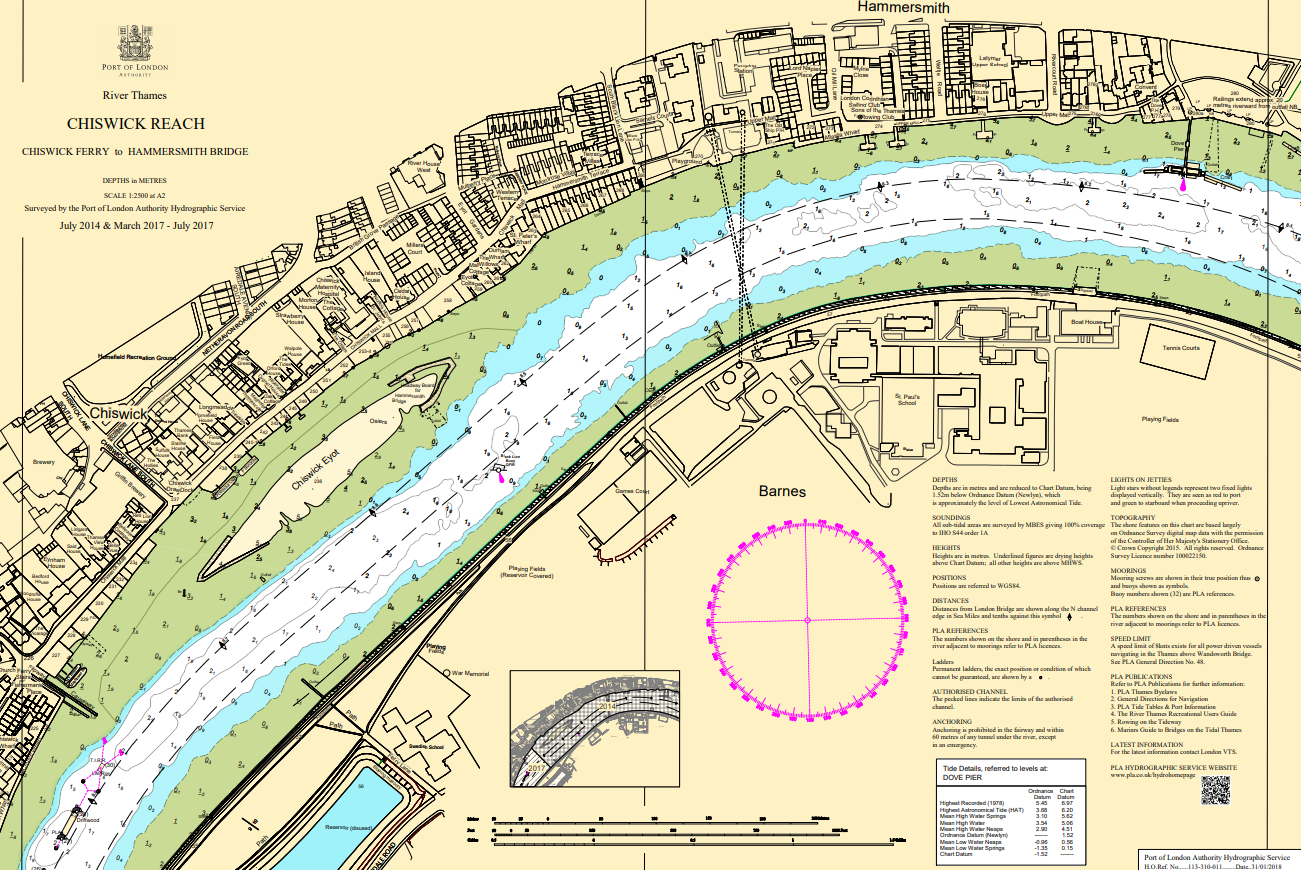
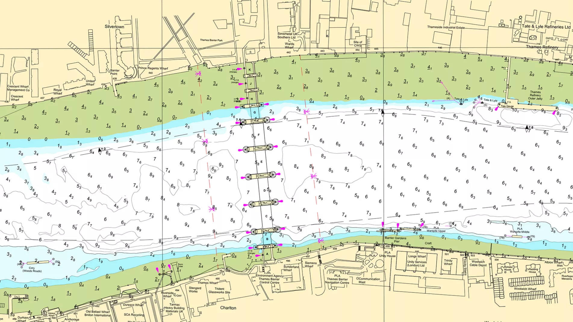
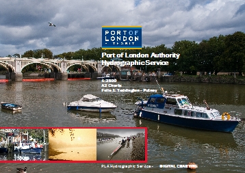
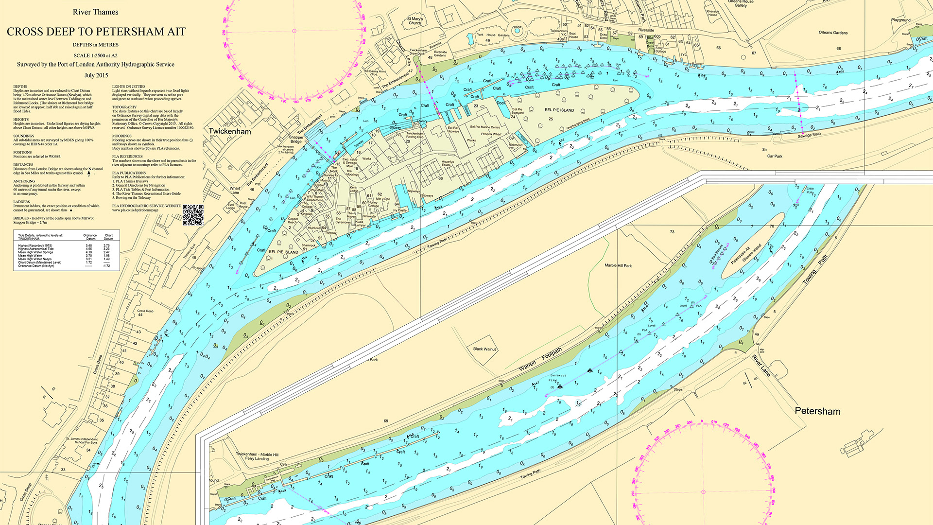
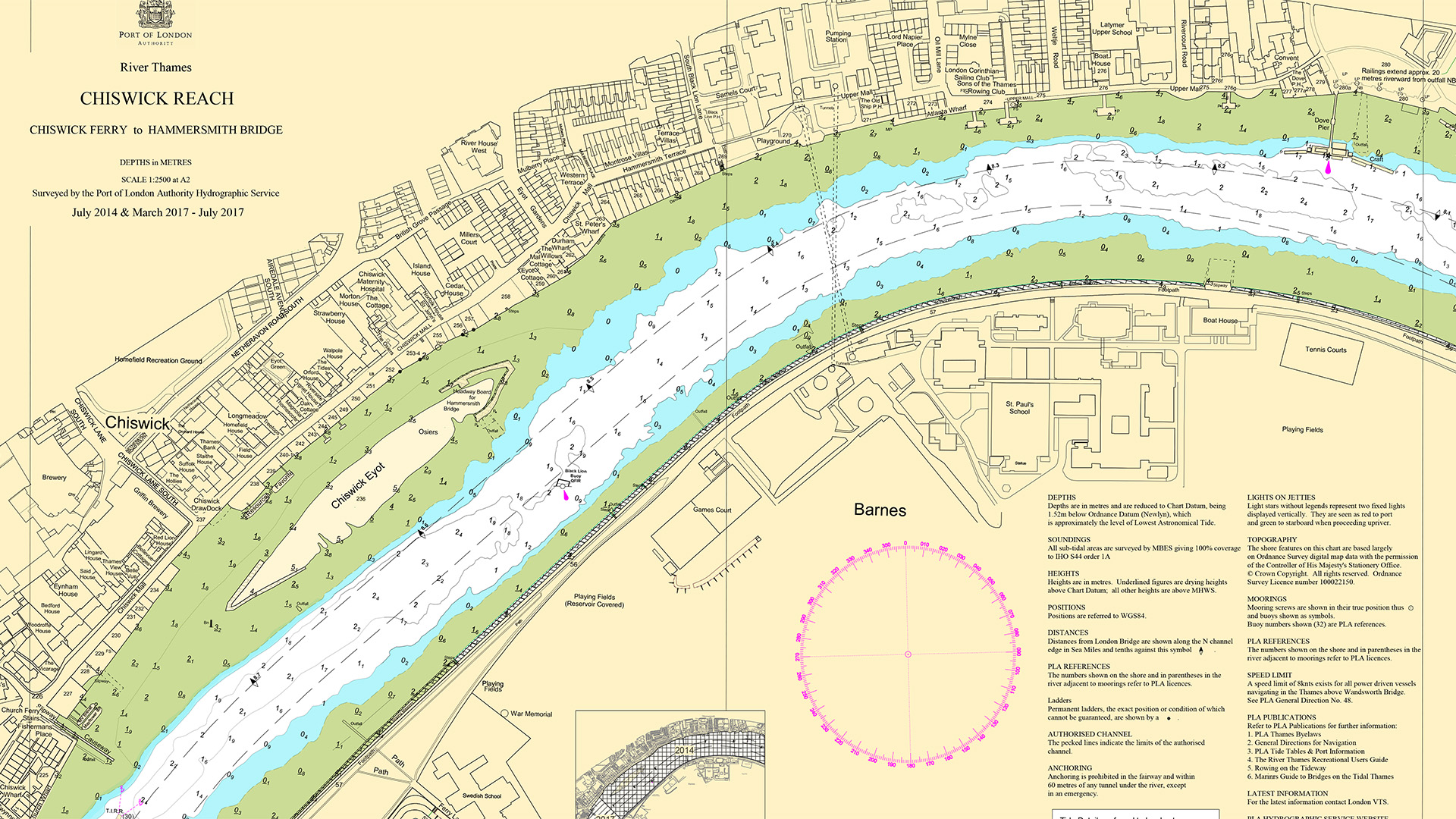
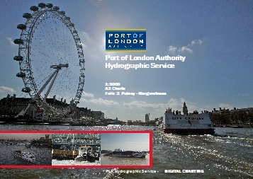
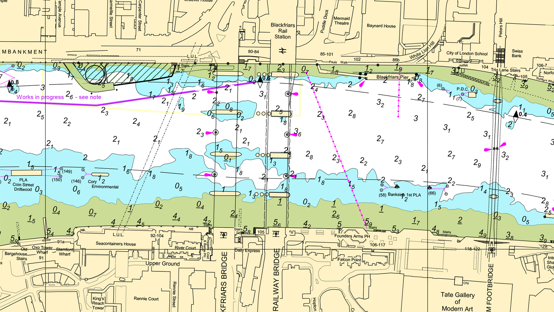
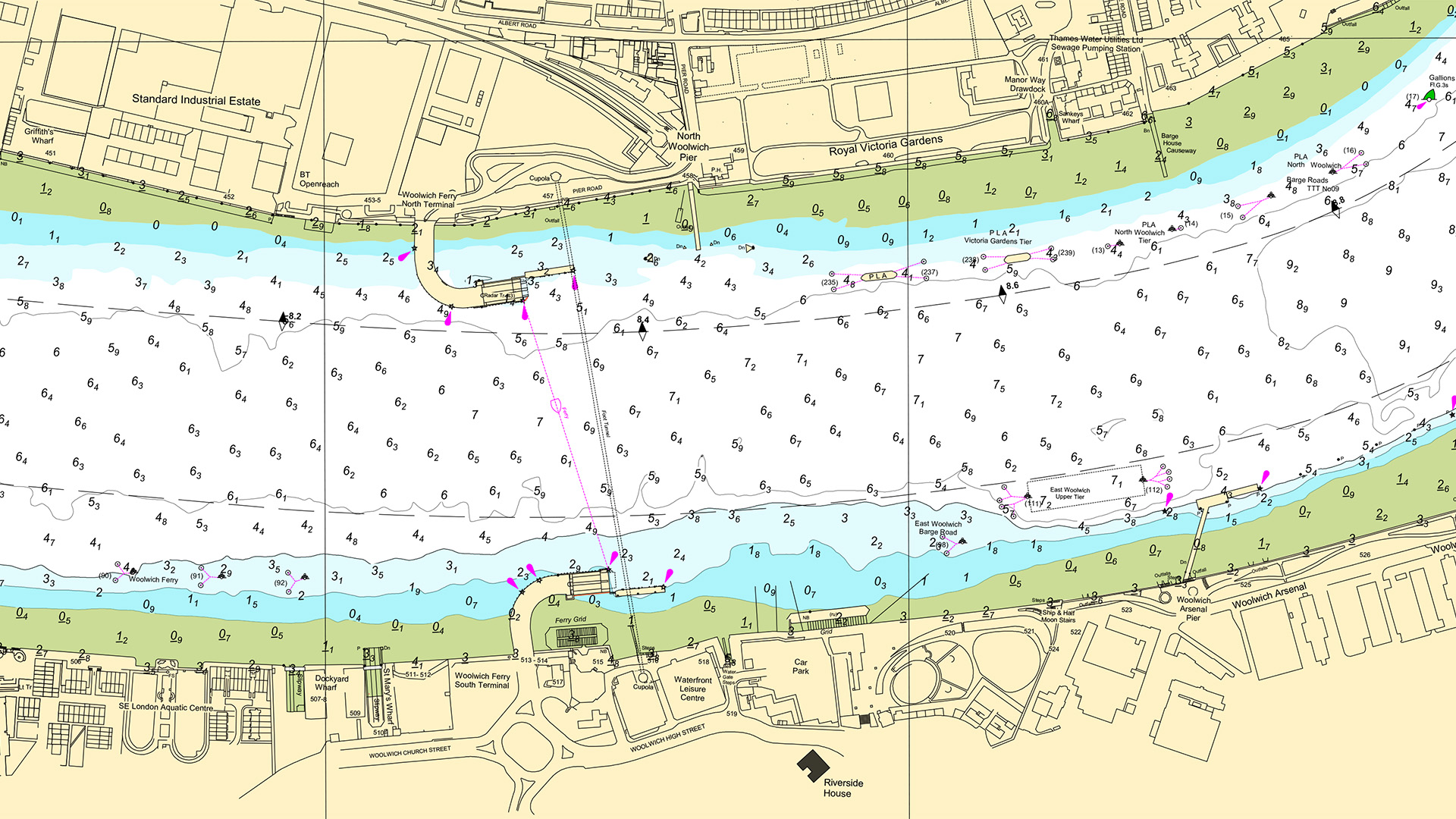
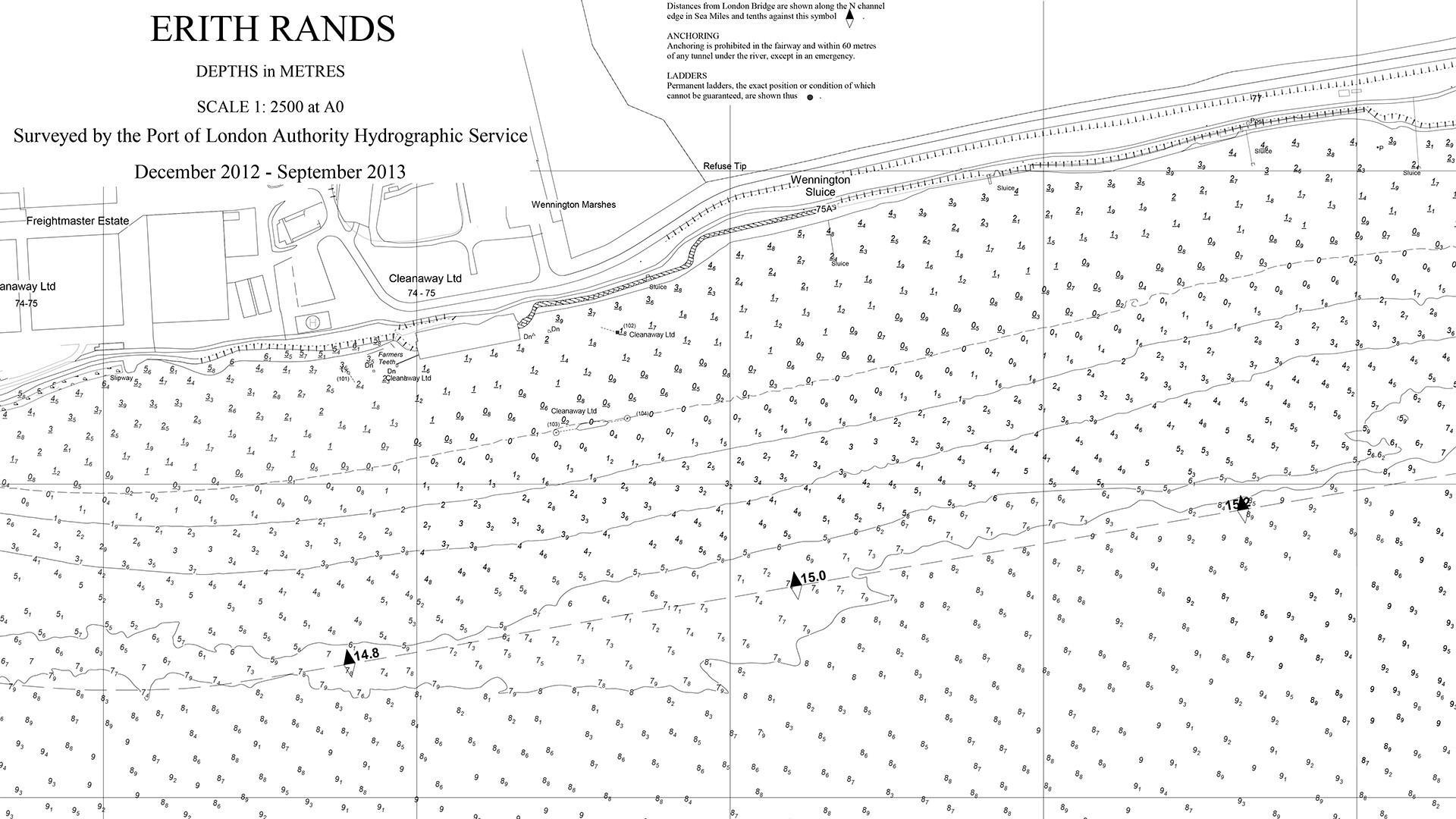
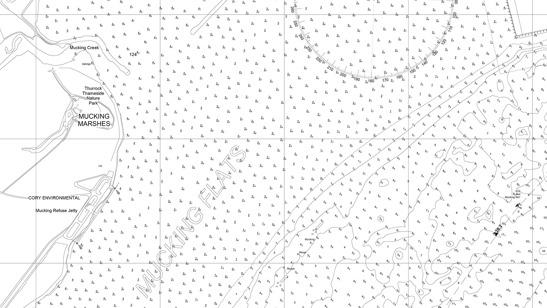
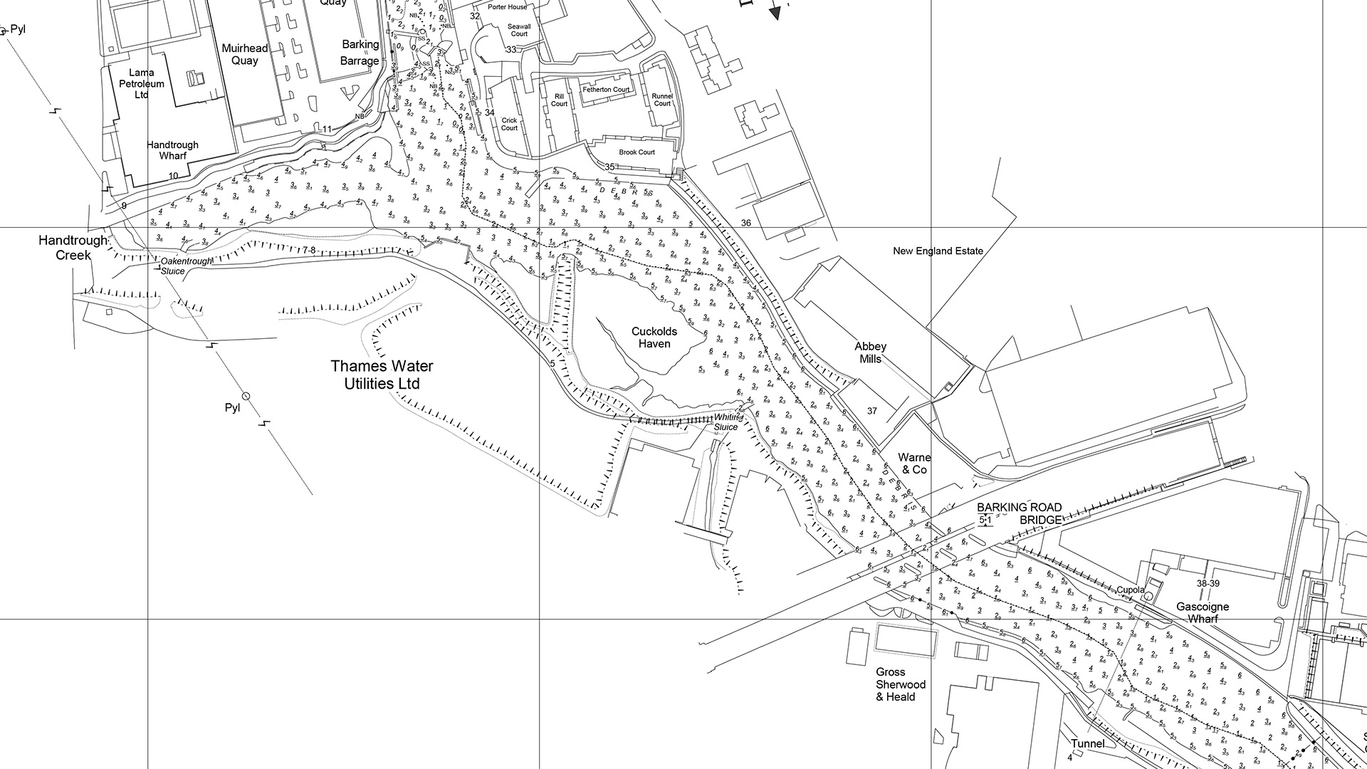
Folios and individual charts
The PLA has re-compiled its series of A0 1:1250 and 1:2500 scale charts into A2 size 1:2500 and 1:5000 colour charts more suitable for navigational use. These are issued as two folios of charts, covering Teddington to Putney (charts 301 - 312) and Wandsworth to Margaretness (charts 313 - 325).
In order to support effective passage planning, the PLA recommends that, where the size and construction of the vessel allows, all commercial, inland waterways vessels carry the largest, appropriate scale of chart for their area of operation.
In addition, and in order to meet the requirements of the national Fitness for Purpose Standard and the forthcoming Inland Waterways Freight Vessel (Technical) Standards for Newbuild Vessels, it will now be a requirement for all such vessels licensed by the PLA to carry suitable charts.
For UK customers
£50.00 + p&p £15.00
(1st class postage for UK customers)
For customers outside the UK
£50.00 + p&p £20.00
(1st class postage for customers outside the UK)
Chart 301-306 Teddington to Putney 1 (A2 size)
For UK customers
£10.00 inc p&p
Chart 307-312 Teddington to Putney 2 (A2 size)
For UK customers
£10.00 inc p&p
For UK customers
£50.00 + p&p £15.00
(1st class postage for UK customers)
For customers outside the UK
£50.00 + p&p £20.00
(1st class postage for customers outside the UK)
Chart 313-319 Wandsworth to Margaretness 1 (A2 Size)
For UK customers
£10.00 inc p&p
Chart 320-325 Wandsworth to Margaretness 2 (A2 Size)
For UK customers
£10.00 inc p&p
Chart 326-334 Woolwich to Tilbury (A0 Size)
For UK customers
£20.00 inc p&p
Chart 335-343 Tilbury to Southend-on-Sea 2 (A0 Size)
For UK customers
£20.00 inc p&p
Chart 376-386 Tidal Creeks
For UK customers
£20.00 inc p&p