Live Tides
NOTICES TO MARINERS
Charts & Surveys
Incident reporting
Life-threatening emergencies on the river:
Call 999 and ask for the Coastguard
For near miss, safety observations and incident reporting click below
Richmond Lock & Weir
Our Grade II*-listed structure is vital to the upper river
On this page
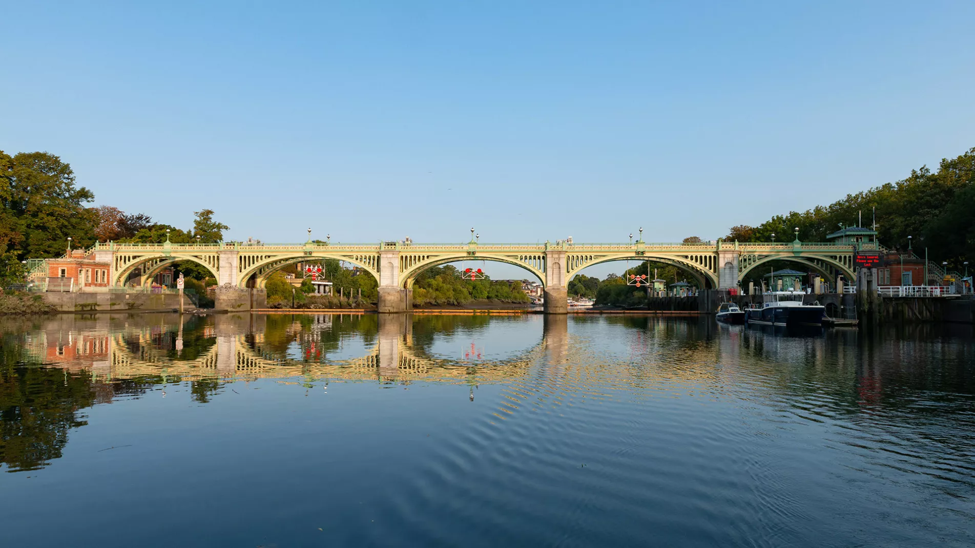
The Port of London Authority owns and operates Richmond Lock & Weir, which is also the base for the Upper River Harbour Service patrols between Putney and Teddington Lock.
Situated between Teddington and Richmond, the weir comprises three vertical steel sluice gates suspended from a footbridge. Each gate weighs 32.6 tonnes and is 20 metres wide and 3.64 metres in depth.
For around two hours each side of high tide, the sluice gates are raised into the footbridge structure above, allowing ships and boats to pass through the barrage. For the rest of the day the sluice gates are closed and passing river traffic must use the lock alongside the barrage.
This period of free navigation can be dramatically changed due to prevailing conditions. In drought conditions the gates will be closed for longer periods, whilst in periods of high fluvial flow they may remain open for much longer. For current information please contact the Lock Foreman on 0208 940 0634.
The sluice gates ensure that the water level between Richmond Lock and Teddington Lock is maintained at or above half-tide level.
The structure was officially opened by the Duke and Duchess of York in 1894 and is Grade II* listed.
PLA completed a major, £4 million refurbishment of the lock and weir in the early 1990s. The lock and weir later underwent a £500,000 repaint that was completed in February 2020.
Navigating Richmond Lock and Weir

A half-tide lock and rising sluice gates operate at Richmond Lock and Weir to maintain the water level towards Teddington at Low Water.
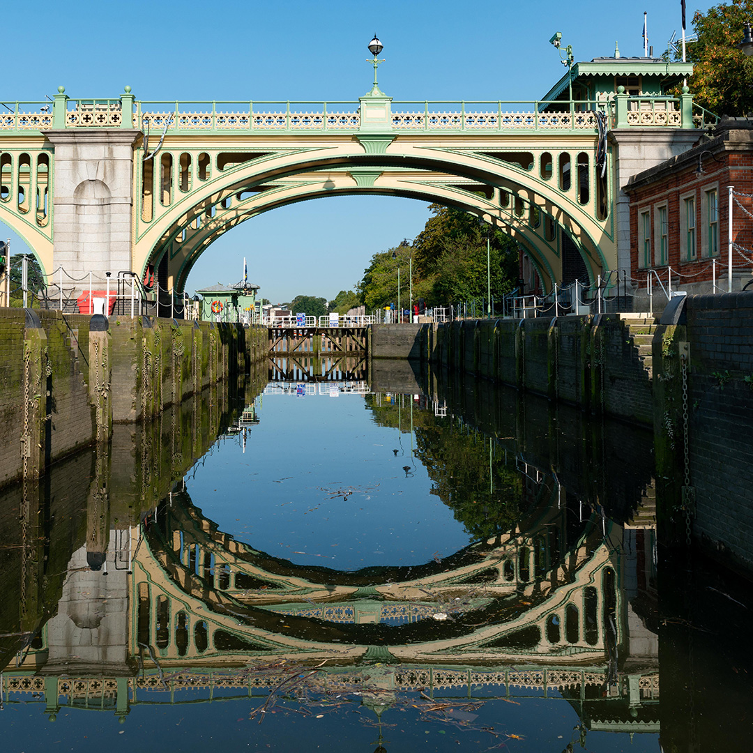
At the times the weirs are in their operational position, arches 2, 3 and 4 will be closed to navigation, this will be illustrated by the arch closure signs and detailed below.
Located in arch 1, the closest arch to the Middlesex riverbank, starboard side of the river, is a boat roller. This is to be used by all Human-Powered-Vessels to transit.
Located in arch 5, the closest ach to the Surrey riverbank, portside of the river, is a half tide lock. This is to be used by all Power-Driven-Vessels.
The lock is 76m long and 8m wide.
Use of the lock, which has a Lock Foreman on duty 24 hours a day:
- All recreational vessels regardless of size, draught or displacement will be charged to use Richmond Lock.
- All commercial vessels determined as those vessels holding a certificate to operate commercially, whether they are engaged in commercial activity at the time of transit or not, will be charged to use Richmond Lock.
- For frequent operators an annual lock pass may be obtained per named vessel, per year payable either in full or quarterly as part of a vessel Annual Port Due.
Notes:
- Return passages on the same day will not be charged in addition.
- No charges will be levied on vessels which use the boat rollers (recently refitted and safe for use by small vessels).
- No charges will be levied on trading barges or tugs towing them.
When the sluice gates are down and the weir closed, the following signals are in operation:
- By Day - 3 red discs in the form of an inverted triangle shown at each arch.
- By Night - An inverted triangle of 3 red lights at each arch.

In addition an illuminated sign on the upper end of lock entrance reads ‘Weirs are closed please use Lock’. The lock or boat rollers must be used in these circumstances by the appropriate vessels.
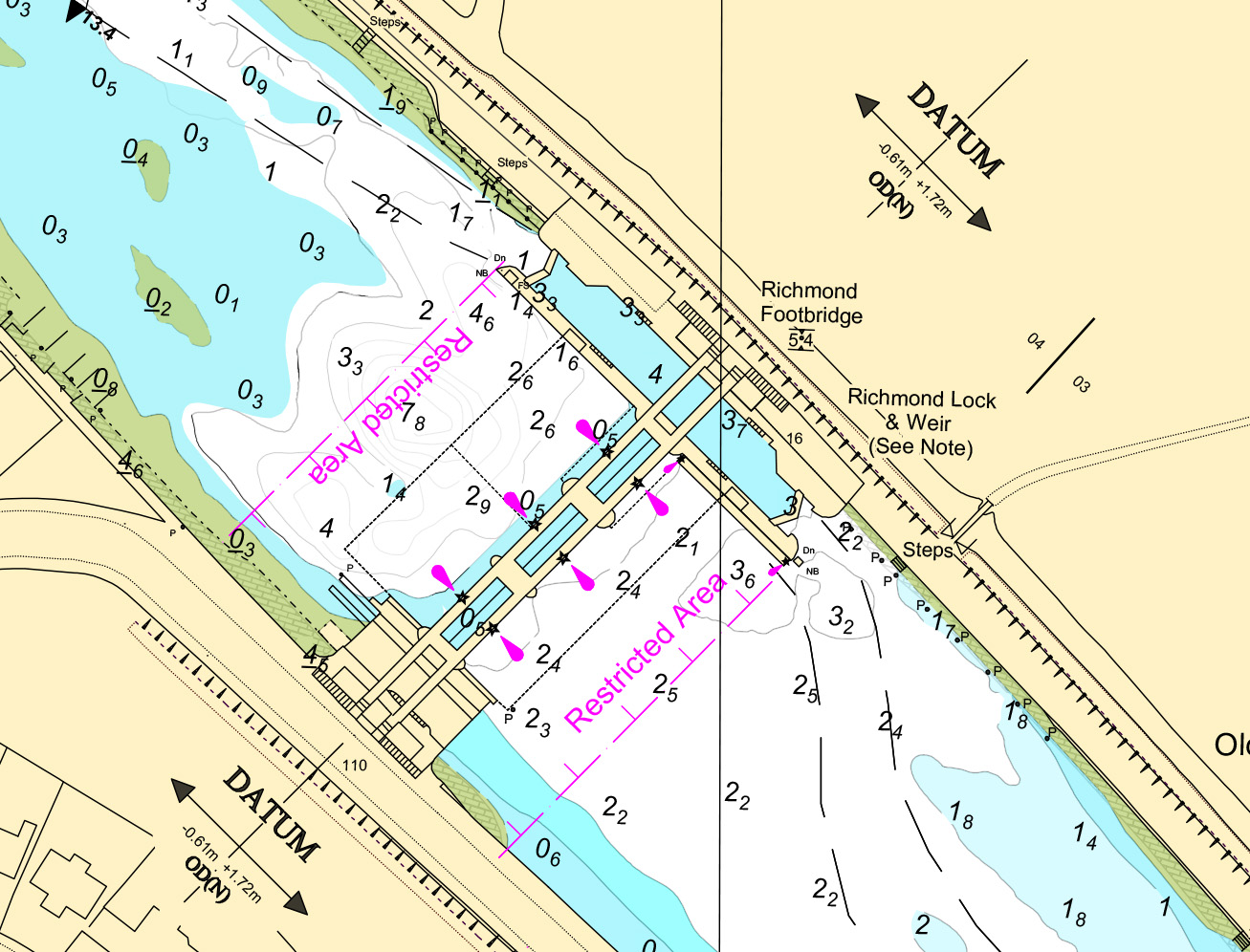
An exclusion zone is established from the extremities of the Lock islands in a line across the river to the Middlesex shore. Mariners should not enter this Exclusion Zone whilst the weirs are in the lowered position or when they are being operated. Only when the weir gates are fully raised and the Closed Arch Signs have been removed is it permitted to navigate into the navigation exclusion zone and through Richmond Footbridge No. 2 or No. 3 arches.
Only those vessels manoeuvring on or to the Lock island berths, vessels engaged in emergency operations or smaller vessels wishing to utilise the boat rollers in No. 1 arch are exempt from this requirement.
For approximately 2 hours either side of high water the weir sluice gates are raised allowing free passage. At these times the following signal is displayed by day and night:
- 2 amber lights shown at each arch - weir open, free navigation.
Mooring trots along the Deer Park bank are expressly for the use of those craft waiting to use the lock. At low water the depth below the weir is restricted and care should be taken when approaching from downstream. The maintained level of water above the weir is 1.72m above OD Newlyn.
Use of Richmond Lock

Multiple low tide predictions at Richmond Lock & Weir
This phenomenon is not an error but due to the prolonged low water period that exists at Richmond. The prediction programme looks for the turning points in the tidal cycle (i.e. where the tide changes from rising to falling). At Richmond this means that slight variations in the prediction can result in consecutive "low" waters. The multiple low waters have not been edited out of the tide tables so as to illustrate the low water stand that occurs.
Mariners' information
From critical depths to tide forecasting, these resources and tools will ease preparation for passage on the tidal Thames.
Latest editions and corrections of our navigational charts are available from our GIS system.
From live tides to predicted lows, we have the tools to assist with your project.
Up to date depth information for points along the tidal Thames.
Tide reductions and tidal stations on the tidal and estuary Thames.
The latest depths for public ship tiers and moorings.
Bridge clearances on the tidal Thames, Bow Creek and Deptford Creek.
Observed water density readings that may be encountered on the Thames.
PLA services and navigation guidance as easy as A, B, C.
Find a distributor of ADMIRALTY Digital Charts.
Discover

 Navigating the lock & weir